What world think about Pakistan?
Pakistan is a terrorist country, politicians are corrupt, people are extremist but despite all these things, we love our country. Pakistan is full of breathtaking locations which will make you fall in love with Pakistan all over again. If you are a tourist or love travelling then you must compile a list of places you plan to visit.
Here are some
most beautiful and best places to visit in Pakistan:
20. North Waziristan
Province: Khyber Pakhtunkhwa
Main language: Pashto (99.6%)
Weather:
Summer season starts from May to September. June is the warmest month. The mean maximum temperatures during the month of June is 31 degrees Celsius and minimum temperature during the month of June is 18 degrees Celsius. Winter starts in October and continues until April.
 |
| Razmak Valley |
 |
| Miran Shah Bazar |
19. Ushu Forest
Province: Khyber Pakhtunkhwa
District: Swat District
 |
| Usho Village in Swat Valley |
 |
| Usho glacier |
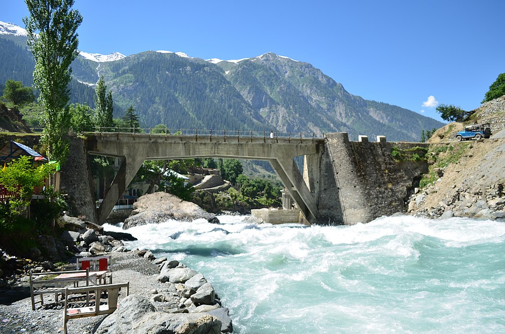 |
| A view of Swat River |
 |
| Jabba Zomalu Lake,Usho |
18. Payee Meadows
Province: Khyber Pakhtunkhwa
It is located at the height of almost 2,895 metres (9,498 ft). It is surrounded by Makra Peak, Malika Parbat, Musa ka Musala and the mountains of Kashmir.The lake is accessible via Kiwai passing through Shogran by a jeep track. There is a problem in breathing there due to elevation.
 |
| Paaye Lake in spring |
 |
| Paaye Lake in spring |
17. Lulusar
Location: Kaghan Valley, Khyber-Pakhtunkhwa
It is located about 48 kilometres (30 mi) away from Naran and is accessible by any kind of vehicle.
 |
| Lulusar Lake |
 |
| Lulusar Lake |
16. Arang Kel
Location: Neelam valley, Azad Kashmir
Elevation: 2,554 m (8,379 ft)
 |
| Arang Kel is set in a verdant valley. |
 |
| It was a beautiful afternoon. The rain was stopped and the sun was shining over the mountains. A farmer started to work in his fields and running a tractor and a women was helping him. |
 |
| Star Trail at Arang Kel |
 |
| Arang Kel Neelum Valley |
 |
| Arrang Kel, AJK |
 |
| Arang Kel in winter |
 |
| Rang Kel in Morning Bliss |
 |
| Charming Arang kel Valley,Kel Azad Jammu & Kashmir Pakistan |
 |
| Arang Kel Village in Azad Kashmir, Pakistan |
 |
| This is the Pic of landscape in Small village named Arang Khel, in Azad Kashmir, Pakistan |
15. Kaghan Valley
Province: Khyber Pakhtunkhwa
District: Mansehra District
 |
| Kaghan is a popular tourist destination because of its dramatic mountain scenery |
 |
| Kaghan Valley “Beauty that Outbound” |
14. Kalash Valley
Province: Khyber Pakhtunkhwa
District: Chitral District
%3B_Tahsin_Shah_01.jpg/1024px-Kalash_of_Birir_Valley_(Coniferous_Forest)%3B_Tahsin_Shah_01.jpg) |
| The three remote valleys are home to the animist Kalash people |
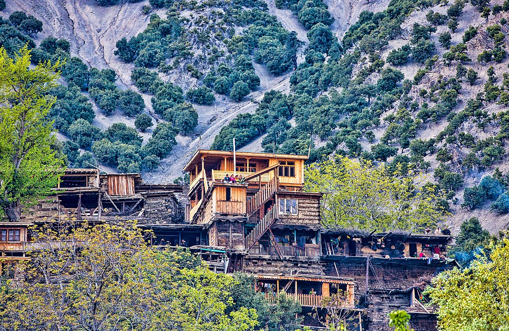 |
| Typical homes in the Kalasha Valleys |
 |
| Bumburet Valley |
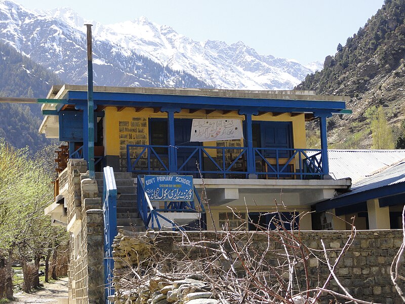 |
| A school in the Kalasha Valleys |
13. Bhurban
Province: Punjab (Pakistan)
District: Rawalpindi
 |
| Bhurban, Pakistan. |
 |
| Bhurban has a wide range of tourist facilities. |
 |
| Pearl Continental Bhurban - 5 star hotel in the town |
12. Chitral
Province: Khyber Pakhtunkhwa
District: Chitral District
Official Language: Khowar
 |
| Clockwise from top: view of Chitral valley and snowcapped peak of Tirich Mir, Chitral's Shahi Qilla, Shahi Mosque, Chitral Fort |
 |
| Chitral's Shahi Mosque |
 |
| Chitral city |
11. Murree
Province: Punjab
District: Rawalpindi
 |
| sunset view in Murree Hills |
 |
| This image was taken in patriatta, murree, punjab, Pakistan. |
 |
| Ayubia Trip Picture |
 |
| Murree Mall in autumn. This marketplace is almost always crowded. |
 |
| View |
 |
| Murree city right side view |
 |
| Murree in winter |
 |
| Dunga Gali |
 |
| some where in murree |
10: Kalam
Province: Khyber Pakhtunkhwa
District: Swat
Climate:
July is the hottest month of the year with an average temperature of 24.1 °C. The coldest month January has an average temperature of 1.5 °C.
.jpg/1024px-Kalam%2C_Swat_(Pakistan).jpg) |
| Kalam Valley |
 |
| A view of the Kooh Lake in Anakar, Kalam Valley |
 |
| Trekkers on the way to Kooh Lake in Anakar Kalam valley |
09: Skardu
Autonomous territory: Gilgit Baltistan
District: Skardu
 |
| Shangrila Resort. The image won the Wiki Loves Earth contest in 2015 |
 |
| The Manthal Buddha Rock dates from the era when the region's population was Buddhist. |
 |
| At an average elevation of 4,114 metres (13,497 ft),[4] the nearby Deosai Plains form the world's second highest alpine plain. |
 |
| Skardu was founded around the year 1500 along the Indus River where it enters a broad valley at its confluence with the Shigar River. |
 |
| Modern Skardu |
 |
| Skardu’s Katpana Lake |
 |
| Skardu is located in a broad valley carved by glaciation. |
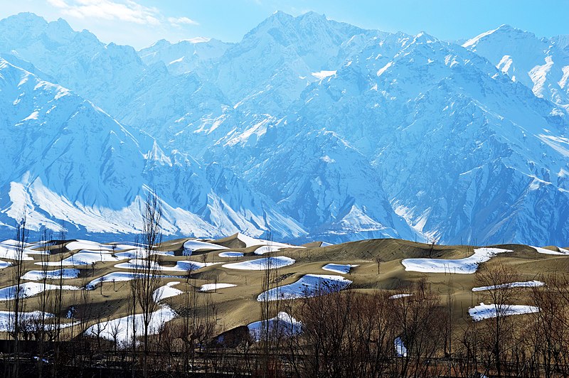 |
| Sand dunes in the Cold Desert of Skardu are often covered in snow during winter. |
 |
| Skardu is located near the Baltoro Glacier - one of the world's longest outside a polar region. |
 |
| Shangri La resort |
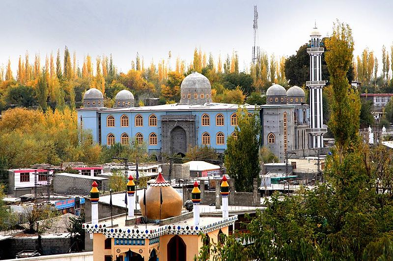 |
| Skardu grand mosque |
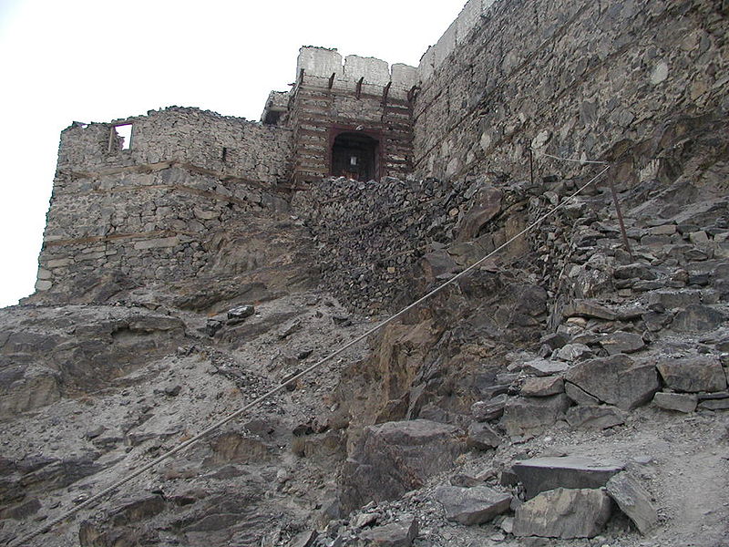 |
| Skardu Fort was built by Raja Ali Sher at the end of the 16th century, and was home to Skardu's local Rajas |
 |
| The Shigar Fort is a 400 year old fort in the nearby town of Shigar. |
 |
| Pakistan International Airlines operates one daily flight to Skardu Airport using a Boeing 737-300. |
08: Rohtas Fort
Location: Jhelum District, Punjab, Pakistan
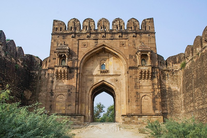 |
| This is a photo of a monument in Pakistan identified as the |
 |
| Rohtas Fort was built upon a hill overlooking the Pothohar plateau. |
 |
| Layout of the fort |
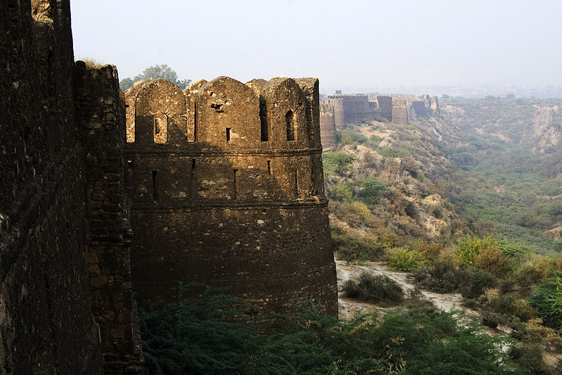 |
| Rohtas Fort is protected by thick defensive walls. |
 |
| Sohail Gate |
 |
| Shah Chandwali Gate |
 |
| Kabuli Gate |
 |
| Remains of the former mosque. |
 |
| The central stepwell. |
 |
| Raja Man Singh haveli |
 |
| Gurudwara Chowa Sahib is located just outside the fort, near the Talaqi gate. |
 |
| Panoramic view of the Rohtas Fort |
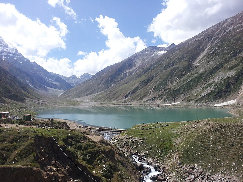
07: Lake Saiful Muluk
06: Nathia Gali
Province: Khyber Pakhtunkhwa
District: Abbottabad
Tehsil: Abbottabad
Elevation: 2,410 m (7,910 ft)
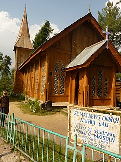 |
| Nathia Gali's St. Mathew's Church was built during the British Raj |
 |
| A Park in Nathiagali |
 |
| A view of Miranjani peak from Nathiagali |
 |
| A view from Nathiagali |
 |
| Abbotabad Nathiagali road |
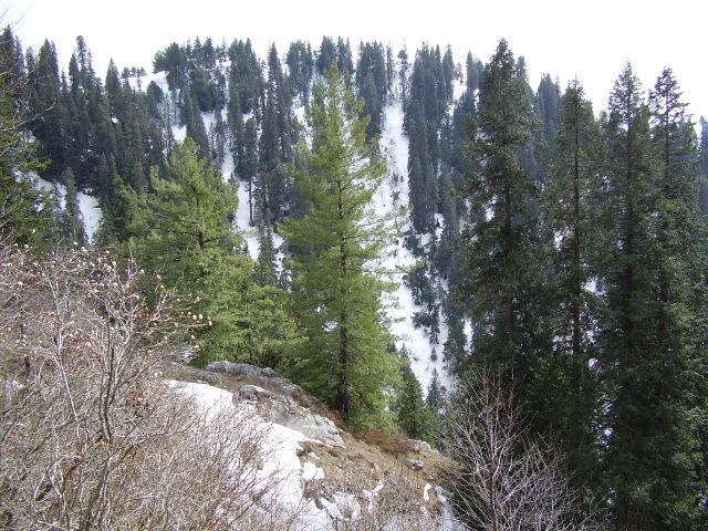 |
| Mukeshpuri peak, in the Nathia Gali area, Khyber Pakhtunkhwa of northern Pakistan. Showing Western Himalayan subalpine conifer forests in Ayubia National Park. Pinus wallichiana is primary conifer. |
04: Kumrat Valley
Province: Khyber Pakhtunkhwa
District: Upper Dir District
 |
| Kumrat Valley Dir upper KPK Hidden nature of Dir Upper |
 |
| The picture has been taken in my home district Kumrat Valley Northern Pakistan. |
 |
| Kumrat valley upper Dir |
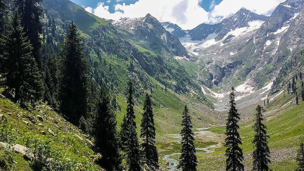 |
| Jahaz Banda in the upper reaches of the valley |
 |
| Kumrat valley |
 |
| Jazz banda dir Swat |
 |
| on return |
 |
| Jazz banda Dir |
03: Attabad Lake
Location: Attabad, Gojal Hunza Valley, Gilgit Baltistan, Pakistan
Max. length: 13 miles (21 km)
Max. depth: 358 feet (109 m)
Water volume: 330,000 acre feet (410,000,000 m3), 26 May 2010
 |
| A disaster has never looked so beautiful before Attabad lake was formed because of landsliding and destroyed several homes |
 |
| The lake submerged the local highway, and all traffic had to be shipped on barges until a new road tunnel was opened for traffic September 2015. |
 |
| A view of the "Cathedral Peaks" from the broader valley at the lake’s northern edges |
 |
| Aerial view of the lake’s southern end |
 |
| Aerial view of the lake’s northern end |
 |
| Hunza lake |
 |
| boats in Atabad lake - Gojal Hunza |
 |
| A beautiful site created by a disaster. |
 |
| Boat ambulance at the lake |
 |
| Boat operators offers scenic boat trips for tourists |
 |
| Panoramic View of Attabad lake |
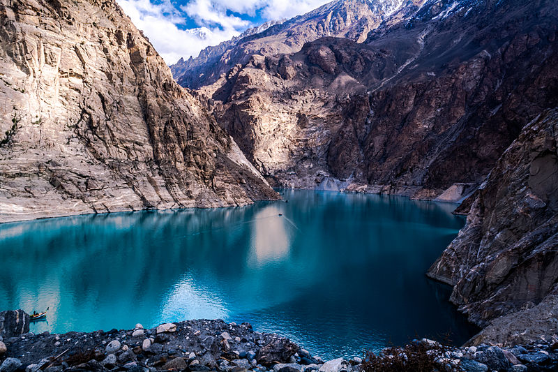 |
| Attabad Lake (Gojal Lake) |
 |
| This is a picture of Attabad lake Near Karimabad a city in gilgit baltistan province of Pakistan |
 |
| Tunnel on Karakoram Highway (lower right in photo) for the realignment |
01: Mantokha Waterfall
Location: Manthokha Baltistan, Kharmang Valley, Gilgit-Baltistan, Pakistan
Total height: 180 ft (55 m)
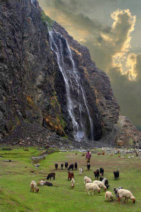 |
| View of Manthoka Waterfall, Skardu |
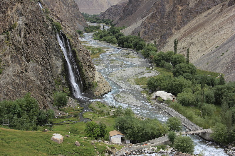 |
| An Aerial view of waterfall |


%3B_Tahsin_Shah_01.jpg/1024px-Kalash_of_Birir_Valley_(Coniferous_Forest)%3B_Tahsin_Shah_01.jpg)


.jpg/1024px-Kalam%2C_Swat_(Pakistan).jpg)






Comments
Post a Comment